Took advantage of a holiday on Good Friday to tackle my third walk. We weren’t sure whether to head further up North but we decided on something closer to home, and something a bit bigger. So we headed to the top of Loch Lomond to tackle Ben Vorlich. This would be my biggest walk so far and also my first munro – Ben Vorlich is 943m, so just over the magic 3000ft mark. It also turned out to be far more difficult than expected.
We started around 9AM and according to the guide books it should have taken around five hours. We took just over seven. Partly this was down to taking plenty stops as it was hard going. Partly it was down to never finding a path up or down Ben Vorlich which made it far more tiring.
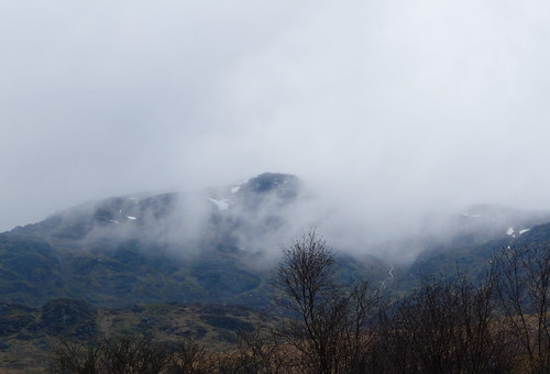
The weather started off a bit wet and we couldn’t see the summit due to the low cloud. We could still see snow though at the top. We hoped the low cloud would lift but unfortunately it didn’t so views were limited which is a shame when you look at some of the views we could have got. The ground was very heavy – boggy, muddy and it made most of the trip up quite a slog. Thankfully the rain lifted though and the cloud lifted a bit but as we neared the summit we lost quite a bit of visibility.
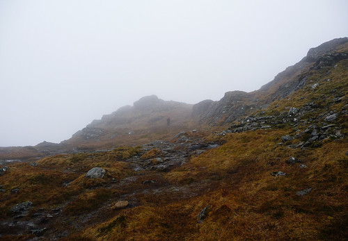
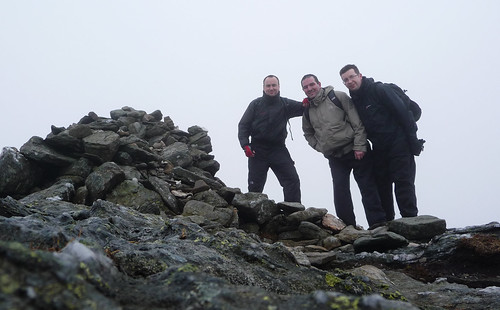
The other problem with the low visibility was the false hope that we were near the summit. Quite a few times we thought we were nearly there…but we weren’t. However the feeling when we finally got there was great.
After finding some shelter from the cold wind and having a well deserved lunch we found and followed a path that should take us west and down. However we lost the path again and after descending quite quickly came to a stop – a ridge with a fairly steep drop. So it was double back time. We ended up cutting across and following the route back down as at least we knew where we had come from. However even then we took a couple of odd routes which added a wee bit to the trek.
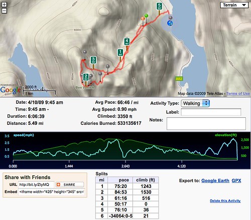
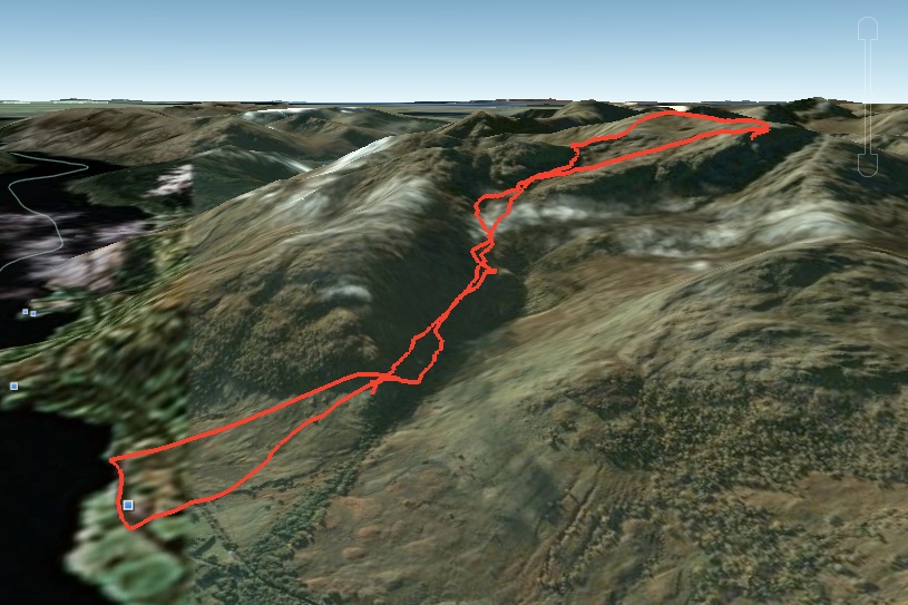
Yet again RunKeeper worked really well. It tracked the route apart from the first 1/2 mile which was my fault for not starting the app. Oops. I’ve also just realised that the route can be exported into Google Earth so you can truly see what route you took in stunning 3D. Speaking off Google Earth, this kmz file will load locations and details of all 284 Munros.
This walk taught me a few things. Firstly, the next walk will need a bit more preparation. We didn’t follow the route, didn’t research it enough and made the walk far harder as a result. It would be also wiser to try and organise the walks for clearer days but this isn’t always possible and you just need to make the best of weather sometimes. Just a shame yesterday wasn’t a bit clearer. It also made me appreciate carrying cold weather gear just in case. At ground level yesterday it was quite mild. At the summit it was around zero degree’s and pretty windy.
Fitness is also an issue. It was a hard slog up yesterday but my legs, particularly my thighs, are really sore today. It’s not so much the fitness on the day but my recovery that is poor. Hopefully that improves with further walks through the year.
The aspect I liked most was the isolation. We were the only three on Ben Vorlich yesterday which made it all the more special. It was great to drive for just an hour and spend the day without seeing anyone else. The feeling on reaching the top was also good. A real sense of achievement. Full set of photo’s are now up on Flickr. Hopefully next months walk will have less cloud!
0 thoughts on “Ben Vorlich”